
快速回答
Route finding on the Ganja La Pass Trek in 2027 is moderately hard to hard. The section between Kyanjin Gompa at 3,830 m and the 5,130 m pass is marked only by occasional stone cairns, has no teahouses for 30 km, and holds snow cover above 4,200 m from November to May. A guide is mandatory under Nepal's 2024 rule. Even experienced trekkers should carry a GPS unit with the route loaded and a 1 to 50,000 scale topographic map. The descent to Tarkeghyang is steep and the trail fades in fog. Allow 9 to 13 days from Syabrubesi to Melamchi Pul.
细分
The Ganja La Pass Trek crosses the 5,130 m pass between Langtang Valley and the Helambu region. The standard route starts at Syabrubesi at 1,550 m, climbs to Kyanjin Gompa at 3,830 m, then crosses Ganja La to Tarkeghyang at 2,560 m and exits to Melamchi Pul at 870 m. Total distance 85 km over 9 to 13 days.
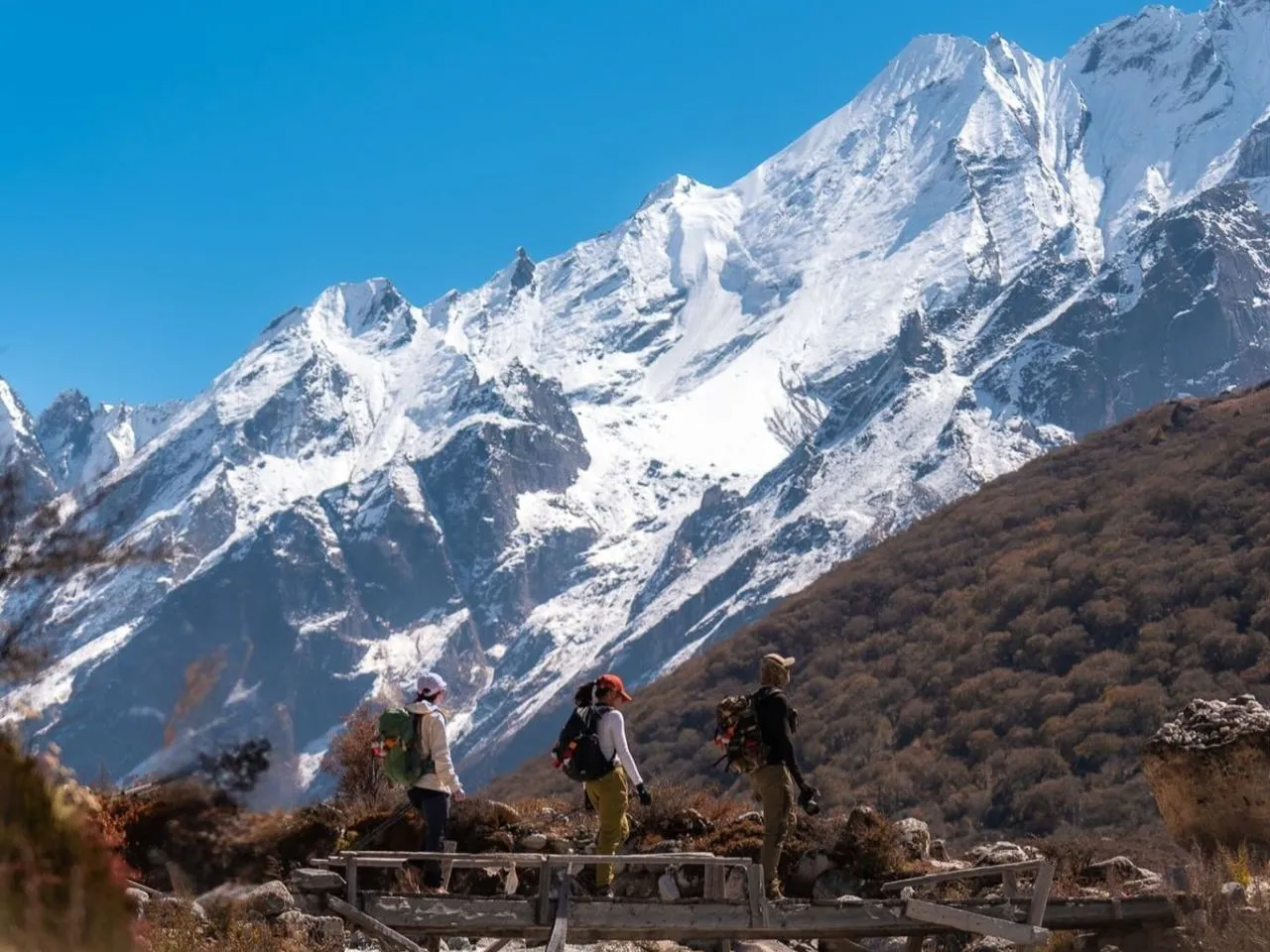
The route between Kyanjin and Ganja La High Camp at 4,960 m is the crux. The trail leaves the main Langtang Valley at Ngegang at 4,000 m and follows a side valley north, climbing through boulder fields and alpine meadows with no teahouses and no permanent settlements. Stone cairns mark the route, but they are spaced 200 to 500 m apart and disappear under fresh snow.
成本/组件分解
| 型钢 | 困难 | Route finding |
|---|---|---|
| Syabrubesi to Kyanjin | 温和的 | Well marked, busy trail |
| Kyanjin to Ngegang | 温和的 | Marked, last teahouse |
| Ngegang to High Camp | 严峻 | Cairns only, no teahouses |
| High Camp to pass summit | 严峻 | Snow slope, cairns |
| Pass to Yangri Kharka | 严峻 | Steep, eroded, fades in fog |
| Yangri Kharka to Tarkeghyang | 温和的 | Marked, teahouses resume |
| Tarkeghyang to Melamchi Pul | 易 | Marked Helambu trail |
| Total pass crossing section | 严峻 | 30 km no teahouses |
什么影响答案
Snow cover is the biggest factor. From November to May the section above 4,200 m holds snow, and fresh snowfall erases the cairn trail. The safest crossing window is June to October when snow is minimal. Winter crossings are not recommended.
Fog and cloud are common in the afternoons above 4,000 m. The pass crossing must start at 4 a.m. from High Camp to reach the summit by 8 a.m. before clouds build. Afternoon crossings risk losing the trail in fog.
Trekker experience matters. Trekkers with prior 5,000 m pass experience and GPS navigation skills can manage the route with a guide. First time trekkers above 4,500 m should not attempt Ganja La.
预订提示
Book through a Kathmandu agency with Ganja La specific experience. Ask for the guide's previous Ganja La crossing count. Generic Langtang guides are not all qualified for the Ganja La section because they may not have crossed it.
Confirm the agency carries a satellite phone for the pass crossing section. There is no mobile signal between Ngegang and Tarkeghyang. Emergency evacuation requires sat phone contact.
Carry a GPS unit with the route loaded. Download the OpenStreetMap or Gaia GPS track for the Ganja La crossing. A smartphone GPS works but battery drain at 5,000 m and cold is high. Bring a power bank of 10,000 mAh.
与替代品的比较
Compared with Larkya La on the Manaslu Circuit, Ganja La is harder in route finding. Larkya La at 5,106 m has a well trodden trail with thousands of trekkers per season. Ganja La sees fewer than 500 trekkers per season.
Compared with Thorong La on the Annapurna Circuit, Ganja La is harder in route finding. Thorong La at 5,416 m has a well marked trail and teahouses at both Phedi and High Camp. Ganja La has no teahouses between Ngegang and Yangri Kharka.
避免的常见错误
Attempting Ganja La without a guide. Nepal's 2024 rule requires a licensed guide, and the Ganja La section specifically demands a guide with previous crossing experience. Generic Langtang guides are not all qualified.
Crossing the pass in winter from December to March. Snow covers the cairns, and the trail becomes impassable. Even the high camp teahouse at 4,960 m closes from December to April.
常问问题
Do I need a guide for the Ganja La Pass Trek?
Yes. Nepal's 2024 rule requires a licensed guide on all trekking routes. The Ganja La section specifically demands a guide with previous crossing experience because route finding is hard and there are no teahouses for 30 km.
What is the safest month for the Ganja La crossing?
October. Stable weather, minimal snow, and clear mornings make October the safest month. June to September is also possible but with more cloud. November to May has snow cover and is not recommended.
Can I cross Ganja La in winter?
No. From December to March the pass is impassable with snow. The high camp teahouse at 4,960 m closes for the winter. Most agencies do not run Ganja La trips in winter.
What fitness level is needed for Ganja La?
Ability to hike 8 hours per day at altitude carrying a 10 kg pack. Prior 5,000 m pass experience recommended. The pass crossing day is 10 to 12 hours including the descent to Yangri Kharka.
总结
Route finding on the Ganja La Pass Trek is moderately hard to hard, with 30 km of unmarked trail between Ngegang and Yangri Kharka, cairns only above 4,200 m, and snow cover from November to May. A guide is mandatory, GPS is essential, and October is the safest month. Allow 9 to 13 days from Syabrubesi to Melamchi Pul.
结局
For experienced trekkers seeking a 5,130 m pass crossing away from the Annapurna and Manaslu crowds, Ganja La is a strong pick in 2027. The route finding is hard but manageable with a qualified guide, GPS unit, and October departure. Book a Ganja La specific agency, carry sat phone backup, and skip the route in winter. The reward is a 30 km section of genuine Himalayan solitude within reach of Kathmandu.
推荐的 Trek 套餐
徒步旅行的地方
Explore Trips in Nepal
Hand-picked guided trips to this destination

 English
 Deutsch
 Svenska
 Dansk
Dansk Русский
 Français
 Português
 Español
 Polski
 简体中文
简体中文 日本語
日本語 ไทย
ไทย العربية
 한국어
한국어